Ever since Google Maps added satellite view, I like to refresh images of buildings to see if they move. Which is silly, because it's not like they can just change on their own...
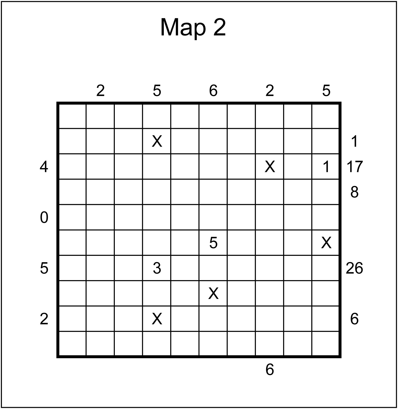
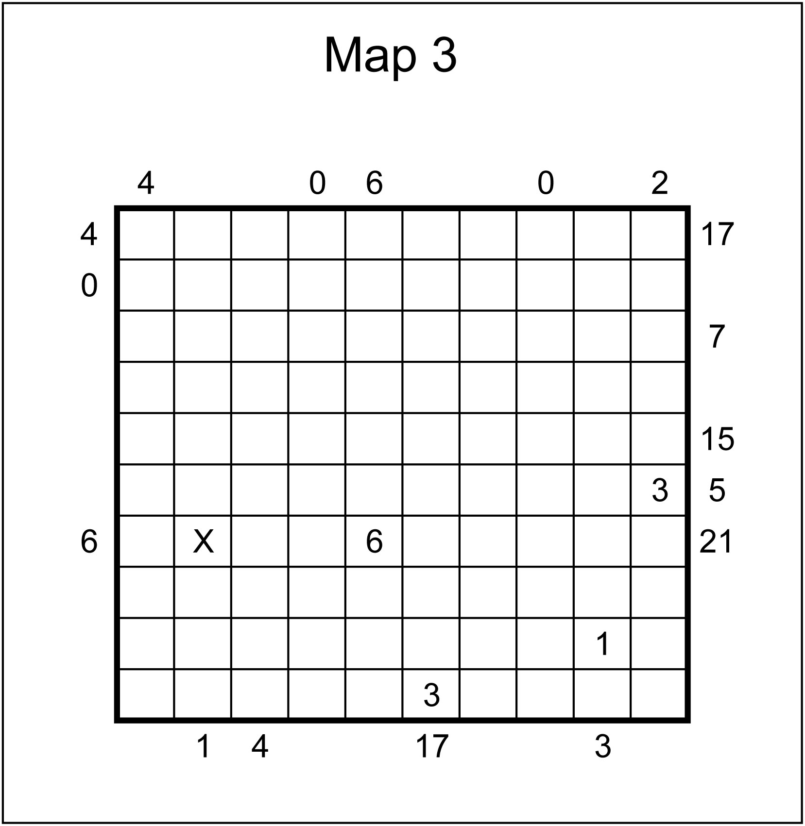
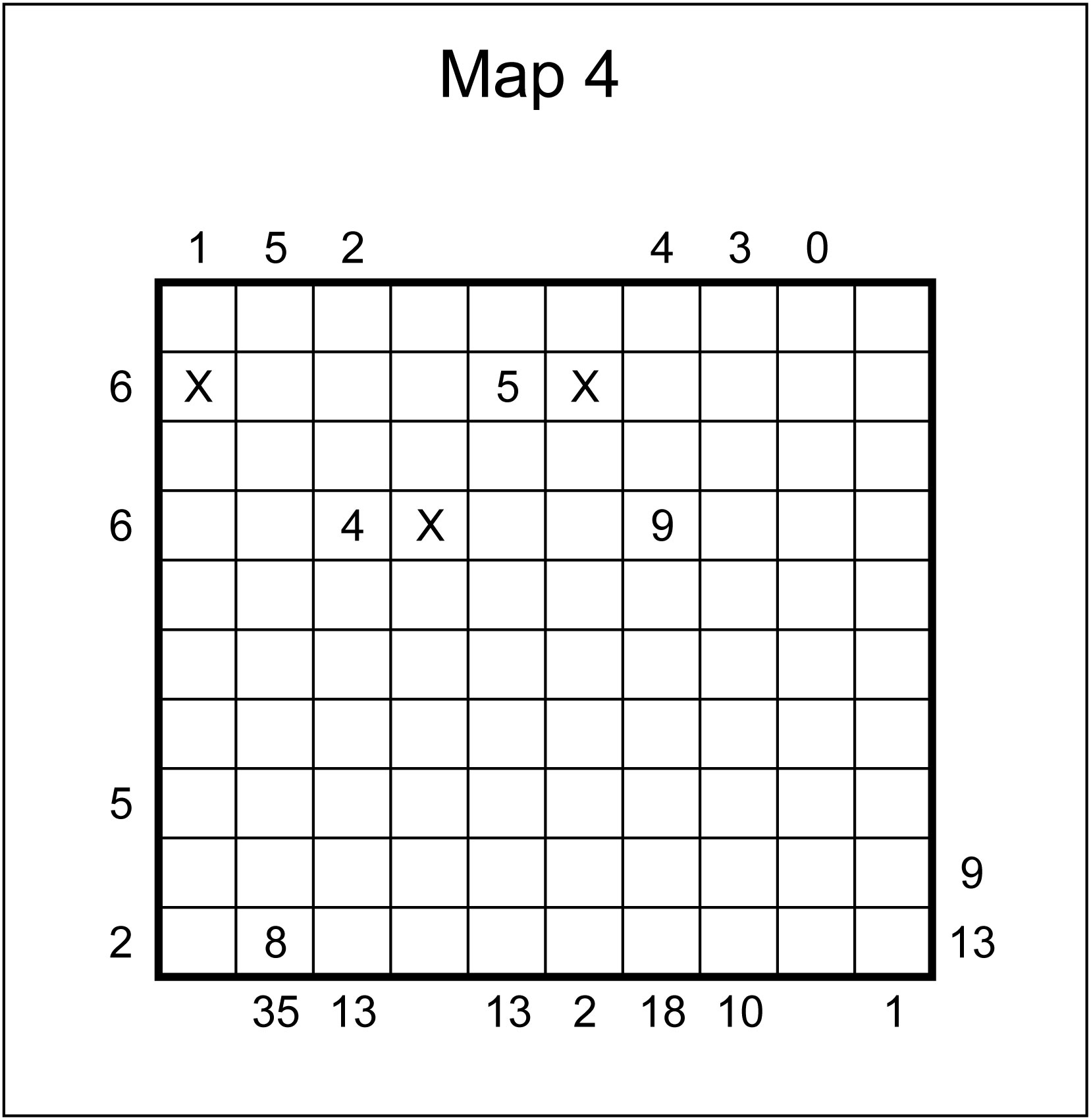
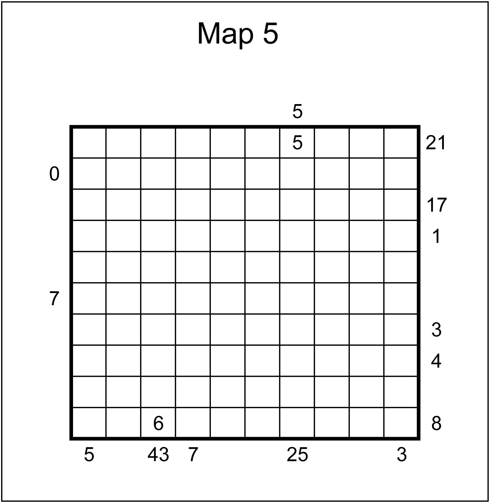
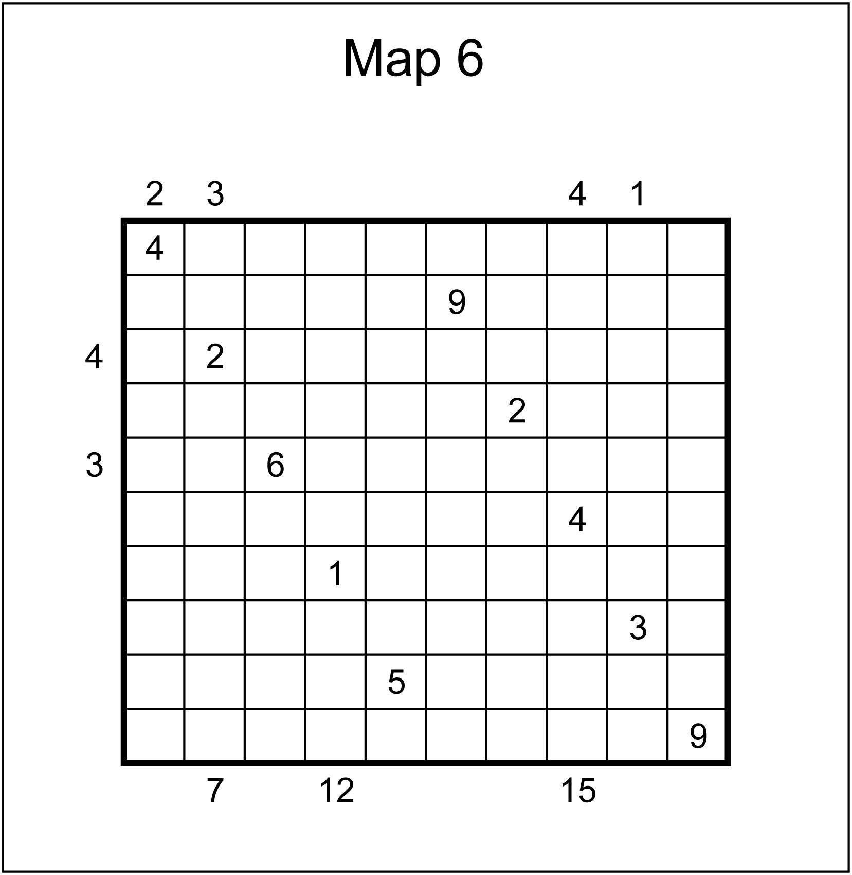
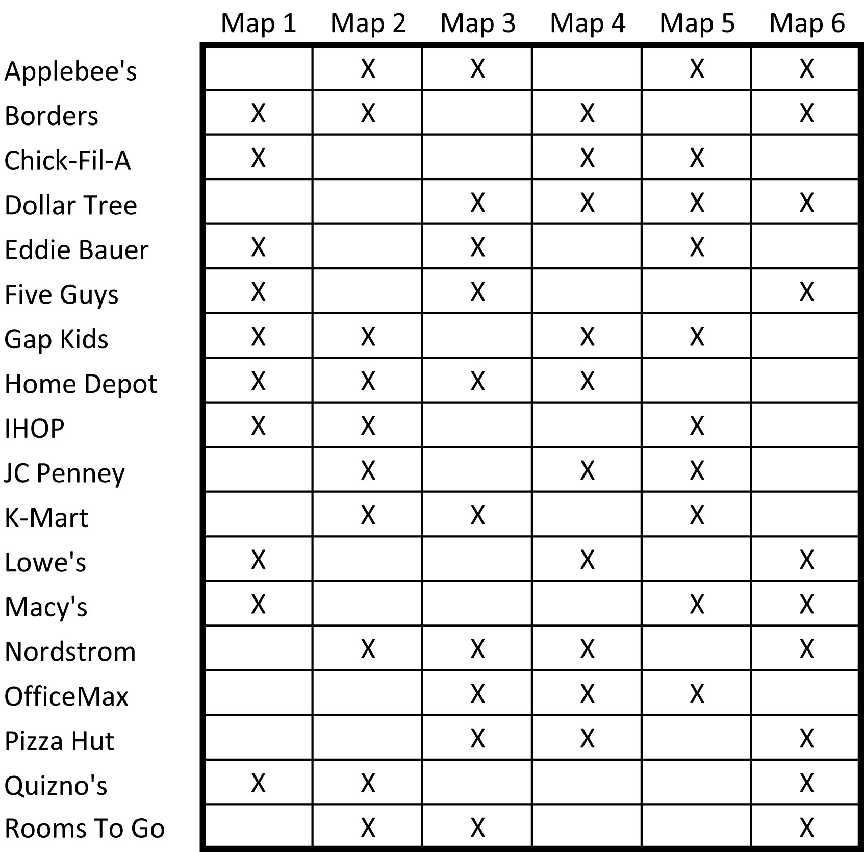
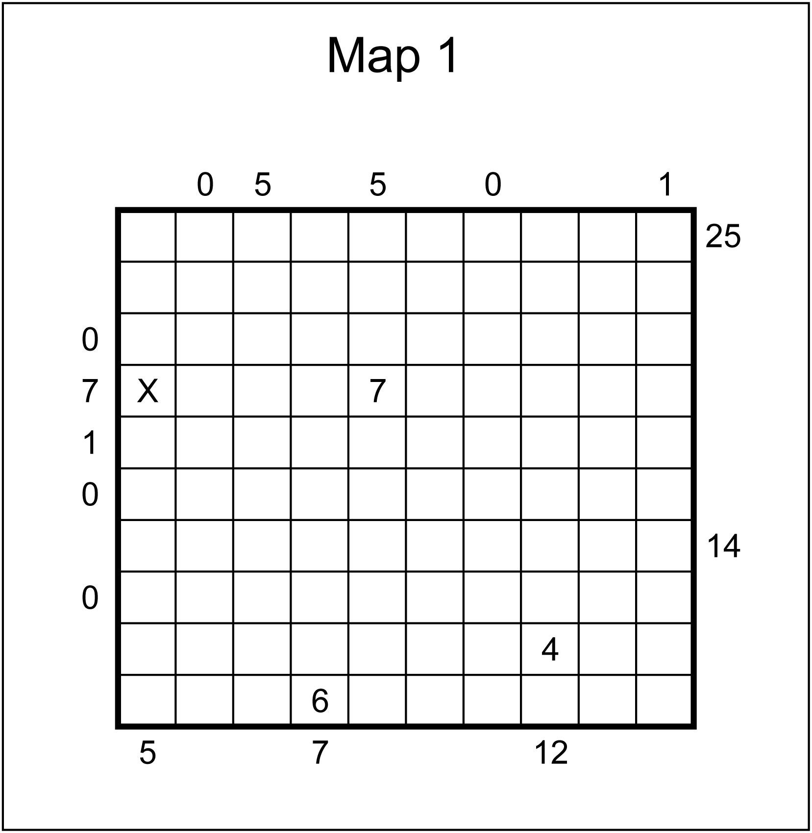
The six maps below represent images of the same shopping center, which is restructured on a disturbingly frequent basis. There are a total of eighteen different businesses that have been part of the center; these businesses are listed in the chart below the maps, which shows which maps each business should appear on.
Each business's building is rectangular, of size either 1x1, 1x2, 1x3, or 1x4. Not being able to see the sides of the buildings, Google Maps keeps track of which building is which by assigning nonzero digits to each square occupied by the building. Buildings appear in different positions on different maps, and they may be rotated; for example, a building that appears as 6-1-3 from left to right in one map might appear as 6-1-3 from right to left, top to bottom, or bottom to top in another map. (It could not appear as 6-3-1... the building itself can be rotated, but the order of digits within the building cannot be rearranged.)
Here are some facts about the maps:
And here are some explanations of the clues that will assist you:
See if you can use this information to determine the numbers Google Maps assigns to each business. I've worked it out myself, but the results just don't seem to add up.